Daily Archives: June 4, 2012
비무장 지대 여행 | DMZ Trip
This past weekend, we went on our final Rotary-sponsored trip to see Korea. For this trip, I was able to see a very important piece of Korea’s modern history. This place was the DMZ (The De-Militarized Zone), which acts as the tense barrier between North and South Korea. This one place is what comes to mind first for many when they hear about Korea, so I really wanted to take the chance to see such an important part of the country.
Mrs. Kim, our Rotary Officer, and her husband, the Principal of our school, joined us for the trip, so we went in their car to 임진각 (Imjingak), a park near the border where the tour bus would depart from. Around the ticket window, there were quite a few monuments, and strangely a carnival. We only looked around for a short time before our bus arrived, and we went off to the first portion of our tour, seeing one of the tunnels that was built by North Korea as part of an infiltration plan. We took the tram car down to the area that the third tunnel was in, and from here, we were able to walk quite a distance down the tunnel to the first of three walls built to prevent use of the tunnel past the actual DMZ line by North Korea. The tunnel was very cramped, so I was not alone in my needing to bend down in order to walk through. The alarming thing to me about this tunnel to me was that it was only discovered because of a tip given by a North Korean defector who knew about it. Apparently, the workers had even put black paint on the walls to try disguising it as a coal mine.
The tour buses ran on a tight schedule, so we had just returned from underground, when they hurried us back onto the bus and off to our next stop, 도라전망대 (Dorasan Observatory), where we would be able to catch a glimpse of 개성시 (Gaesung City) and the surrounding farmland. This city is considered to be somewhat of a fake city set up by the North Korean government, where few people actually live, but it is staged to show a more wealthy style of living. Using one of the coin operated binoculars, I was able to see only a few cars and people working in the field. The striking feature though is the gigantic flag pole that towers above part of the city, echoing a smaller one on the other side of the border set up by South Korea. At this point, we could only take pictures from behind a specific point, but thanks to a good zoom on my camera, I was able to capture a few good pictures, but not as many as I would have liked before we had to head back to the bus. This part of the tour was definitely the most interesting to me, as it really was very different to think of North Korea as a place than it was to actually see the country.
We made one more stop during our tour in order to see 도라산역 (Dorasan Station), which is the final station on the South Korean side of a rail line built to connect the two countries. Unfortunately, shortly after being built the peace talks that had allowed its construction connecting through to Pyeongyang, was not enough to get it so that trains would run. So, instead, this station sits unused. If the connection could eventually be used, though, it would certainly be important, as it would create a connection that would allow one to travel by rail all the way from South Korea to Portugal, completely crossing both Europe and Asia.
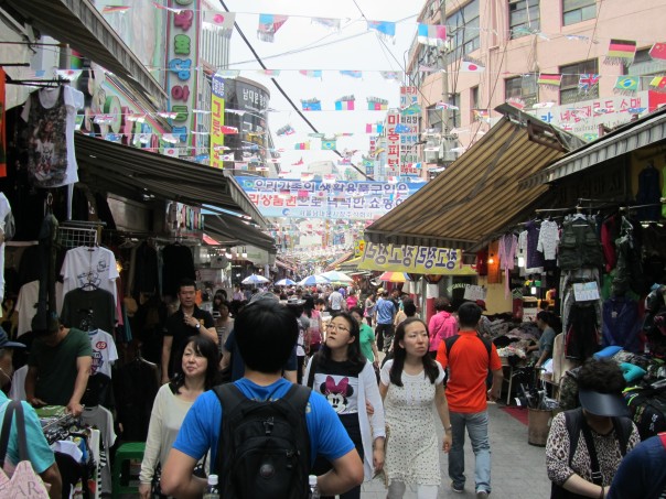
When we got back to Imjingak, where our tour bus departed, we went by car to Seoul, where we would spend the night. The next day, the major thing that we did was visiting 남대문 (Namdaemun), one of Seoul’s Market Areas, so that we could do some souvenir shopping. Mrs. Kim and the Principal had to head back to Seocheon early, so it was just the exchange students for the day, and from our experience from past trips, we easily made our way home on the train after the interesting trip.


